
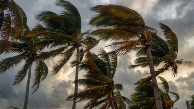

Mauritius weather today is making headlines, with a strong wind and heavy swell warning now in effect across the island and surrounding seas. If you’re visiting the island this week, here’s what you absolutely need to know to stay safe and make the most of your trip.
Key details for tourists
- Strong wind and heavy swell warning: In force from now until 22:00 on Sunday, 30 August 2026.
- Expected wind speeds: Strengthening to 45 km/h, with gusts around 90 km/h.
- Rough seas: Swells of 4 to 6 metres beyond the reefs, with risk of tidal surges especially at high tides.
- Highest danger zones: Low-lying coastal areas in the West and South.
- Beaches and sea: Fishermen, pleasure-craft users, and the public are strongly advised not to go out at sea or walk along affected beaches during high tide.
- Partial lunar eclipse visible: Today from 05:22 to 11:04 (local time).
- Tide times Mauritius: High tides at 13:17 and 01:06 (next morning); Low tides at 07:08 and 19:08.
Mauritius weather today: What to expect
While much of Europe is in summer mode, Mauritius is in the heart of its winter season, but this winter packs a punch, especially today. Early this morning started off fair, but expect the weather to shift as clouds from a cold front roll in, bringing on-and-off rain through the day. Intermittent showers are set to hit hardest over the south and the central plateau, with occasional fog patches making for tricky driving in those higher areas.
For anyone out and about: pack a light rain jacket. If you’re headed to higher ground (like Vacoas or Chamarel), expect cooler daytime highs between 19 to 21°C and night-time lows dipping to 14 to 16°C. On the coast (Grand Baie, Flic en Flac, Blue Bay, etc.), you’ll see warmer highs between 23 to 26°C, with nights staying milder at 18 to 21°C.
Mauritius Trip Planner
Winds and sea safety: Take this seriously
All travelers, especially those considering boat tours, fishing, or coastal walks, should take today’s strong wind and heavy swell warning seriously. Winds from the south are picking up quickly, and those gusts over 90 km/h can knock down branches, loosen roof sheeting, and send debris flying. The sea, beyond the protective reef, is very rough, with waves of 4 to 6 metres. The risk for dangerous tidal surges is highest in the west and south, and coastal flooding during high tide is possible in these areas.
- Avoid the sea entirely: It’s genuinely dangerous for boats of all sizes. Skip snorkeling, kitesurfing, and even stand-up paddle boarding today.
- Keep off the sand during high tide: Steer clear of exposed or low-lying beaches in the south and west during the 13:17 and 01:06 high tides.
- Driving tips: On exposed roads, like the route near Gris Gris or Macondé, expect strong crosswinds. Drive slowly, stay alert, and don’t try to stop for photos if the wind is tossing sand or branches onto the road.
- Watch for debris: If you’re staying near construction or tall trees, park your car where it’s sheltered if possible.
Partial lunar eclipse: Early morning highlight
If you’re an early riser or just jet-lagged from a long flight, you’re in luck. Mauritius will be treated to a partial lunar eclipse today, visible from 05:22 until 11:04. If the skies stay clear enough, hard to predict exactly with today’s cloud cover, you might catch a glimpse of the moon’s shadow play over the early morning horizon.
Tourist tips and practical advice
- What to bring: Rain jacket, warm layer for evenings, and secure loose items (like pool inflatables or laundry hung out on balconies).
- Avoid water sports: All operators shut down tours during official warnings. If you’ve pre-booked, double-check with your provider for rebooking options.
- Check the Met Service: For the latest on weather changes, warnings, and safe tide times, visit the Mauritius Meteorological Services.
- Stay flexible: If the rain breaks in the afternoon, open-air attractions (botanical gardens, markets) can be pleasant once showers clear, but always check the latest local forecast first.
For regular travel weather advice, check previous updates like yesterday’s Mauritius weather forecast.
From my own time living here, I’d say days like these are common for late August in Mauritius, short, sharp bursts of rough winter weather bring drama to the sea and cool air to the hills, but things usually clear pretty quickly. Stay safe, keep an eye on the wind, and don’t take risks by the water.
Source: Mauritius Meteorological Services
Frequently Asked Questions
How long will the strong wind and heavy swell warning last in Mauritius?
The warning is in effect until 22:00 on Sunday, August 30, 2026.
Is it safe to go swimming or boating in Mauritius today?
No, the sea is very rough with high waves and tidal surges. All water-related activities should be avoided until the warning is lifted.
What temperatures can I expect in Mauritius today?
Expect 19-21°C on the central plateau and 23-26°C along the coast, with cooler nights inland.
Will the partial lunar eclipse be visible in Mauritius?
Yes, the eclipse is scheduled from 05:22 to 11:04 today, though cloud cover may affect visibility.
Stay updated with local expert-guided experiences—our team can help you make the most of Mauritius, whatever the weather brings.
Discover catamaran cruises & sea trips →