
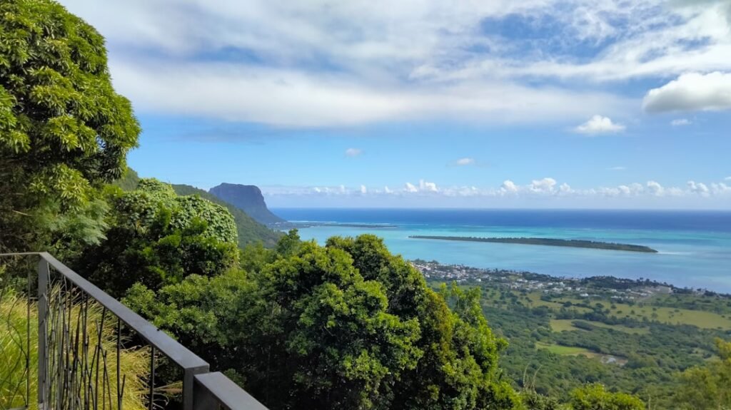

The Mauritius weather forecast for Thursday, August 27, 2026, brings a day of changing skies, something every visitor should consider before heading to the beach. If you woke up to cloudy conditions across the island, you’re not alone. Early showers hit the east, north, and the highlands, but much of the day is set to be fair, with warmer than average temperatures for our late winter season.
- Date: Thursday, August 27, 2026
- Daytime temps: 23-25°C (highlands), 27-30°C (coastal areas)
- Night temps: 14-17°C (central plateau), 19-22°C (elsewhere)
- Wind: Light and variable, strengthening late at night
- Sea: Moderate, becoming rough with 2m southwesterly swells beyond reefs
- High tides: 13:00 and 00:38 (tomorrow morning)
- Low tides: 06:45 and 18:46
- Sunrise: 06:23
- Sunset: 18:00
- Strong cold front and windy weather expected Friday, August 28
Today’s Forecast and What It Means for Tourists
This morning, expect lingering showers mainly on the east and north coasts, as well as over the highground areas like Vacoas. Don’t be surprised if your morning coffee at a seaside café is accompanied by a light drizzle, keep an umbrella or a light jacket handy if you’re heading out early. For most of the day, however, Mauritius will enjoy mainly fair weather, with above-average warmth, especially on the coast. If you’re longing for a winter tan, you’re in luck: coastal highs can reach up to 30°C, which feels great after a chilly night. The nights do cool off, particularly in the central plateau. If you’re staying in places like Curepipe or Moka, you might want to pack a jumper for the evenings.
Afternoon Showers and Sea Conditions
In the afternoon, clouds will build up over the west, northwest, and parts of the central plateau. A few localised showers are possible, these tend to be brief, but if you’re planning a hike or a drive inland, check forecasts before you go. On the coast, conditions stay mainly dry, inviting beachgoers and swimmers. But there’s a big caveat for water lovers today: by late morning, the sea will become rough, with swells reaching around 2 metres beyond the reefs. This is not the day for open sea boating or extended snorkelling trips. Ventures into the open sea are not advised, and if you’re staying in the west or south, be extra cautious, swells can quickly make usually tranquil waters challenging.
Mauritius Trip Planner
Mauritius Weather Forecast: Upcoming Cold Front and Safety Precautions
While today should stay mostly fair, travelers should be prepared for a rapid change starting Friday, August 28. A cold front and a strong anticyclone are approaching from the southwest. What does this mean? After a rainy start on Friday, expect much windier and colder conditions. Exposed areas could see gusts up to 80 km/h, and daytime temperatures will drop by about 4°C compared to today. This can make a serious difference in how comfy you feel outdoors, especially on those scenic clifftop walks popular along the west and south coastlines.
The sea is a major concern. Swells from the southwest are forecast to grow even further, causing very rough seas and potential tidal surges, especially at high tide (around 13:00 today and 00:38 Friday). Low-lying coastal areas in the west and south face an increased risk of minor coastal flooding. If you’re staying at a beachfront villa or planning an excursion, check directly with your accommodation for local advice. It’s best to avoid the open sea until conditions ease, and even lagoon swimming calls for caution.
Practical Travel Advice for Today (and Tomorrow)
- Pack extra layers for cooler evenings on the central plateau.
- Bring a compact umbrella for passing showers if exploring the east, north, or highlands in the morning.
- Beach walks and sunbathing along many coasts are excellent today, but reconsider water activities, especially past the reefs.
- Plan your outdoor adventures early; cloud buildup and showers are more likely this afternoon in the west and central areas.
- Watch the surf and avoid unguarded beaches in the west and south, especially at or around high tide.
And as someone who calls Mauritius home, here’s a small tip: when the meteorological service talks about a cold front, locals know to expect an overnight wardrobe change, don’t be surprised if you see people in windbreakers and jumpers tomorrow morning.
For more advice, check Mauritius Meteorological Services.
If you’re planning island adventures over the next days, keep this weather pattern in mind. And for further tips on safe travel this season, see our Mauritius Weather Today: August Forecasts, Sea Safety, and Travel Tips.
Source: Mauritius Meteorological Services
Frequently Asked Questions
Is it safe to swim in Mauritius today?
It's best to avoid open sea and lagoon swimming today due to rough seas and high swells, with even riskier conditions expected from Friday onward.
What should I pack for today's weather in Mauritius?
Bring a light jacket or jumper for cooler evenings and a compact umbrella for morning or afternoon showers, especially inland or on the east coast.
When will the weather worsen in Mauritius this week?
A cold front and anticyclone will bring much windier, rainier, and colder weather starting Friday, August 28, with possible coastal flooding.
Are there any flood risks for tourists?
Yes, tidal surges and rough seas could cause coastal inundations in low-lying west and south coast areas around high tide, so check with your accommodation.
Stay up to date with the latest weather before planning your Mauritius day tour or outdoor adventure at MauritiusEvents.com.
Discover catamaran cruises & sea trips →