
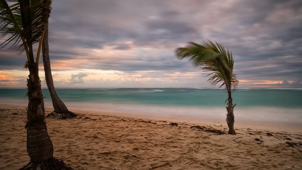

Mauritius weather today presents a challenging start to the week for tourists and locals. If you’re waking up in Mauritius this Sunday, August 30, you’ll notice the wind roaring through the trees and a distinct chill in the air. The Mauritius Meteorological Services has issued an important alert affecting visitors, especially those hoping for carefree beach days or coastal excursions.
Key details for tourists today
- Warning in force: Strong wind and heavy swell warning valid until 10h00 on Monday, 31 August 2026
- Issued: Sunday, August 30, 2026 at 04h30 (local time)
- Weather today: Very windy and cold, with cloudy periods and intermittent rain (mainly East, South, Central Plateau)
- Highground temperatures: Max 17, 20°C, Min 13, 15°C
- Coastal region temperatures: Max 23, 25°C, Min 16, 18°C
- Wind: Southeast 30, 40 km/h, gusts up to 90 km/h possible
- Sea conditions: Very rough beyond reefs, Southwesterly swells 4, 6 metres
- High tides: 13h59 today and 02h06 tomorrow
- Low tides: 07h57 and 20h03
- Sunrise: 06h20, Sunset: 18h00
Focus keyword: Mauritius weather today, What to expect
A powerful anticyclone south of the Mascarenes is behind this latest round of Mauritius weather today. The result? It feels much colder than average, especially on the central plateau and in the island’s southern and eastern pockets. Intermittent rain will move through at times, leaving many outdoor activities looking less appealing than usual. Even Port Louis, shielded from the strongest winds, will have a grey sky with temperatures only around 26°C.
On the coastal strips, you’ll see temperatures reaching up to 25°C, but don’t expect calm turquoise waters or postcard beach scenes. If you’re planning a picnic, I’d honestly advise postponing it until later in the week. That southeast wind is relentless, and gusts at 90 km/h can send sand and light furniture (or hats) flying!
Mauritius Trip Planner
Sea conditions and safety warnings
This is critical for anyone considering sea-based adventures. The Mauritius Meteorological Services are strongly warning all fishermen, pleasure-craft users and beachgoers not to go out at sea until the warning lifts at 10h00 on August 31. Swells offshore will reach 4 to 6 metres, and beaches on the west and south coasts are especially vulnerable to tidal surges during high tides. Low-lying coastal zones risk short-term flooding.
- Do not venture beyond the reefs or attempt boat trips.
- During high tides (13h59 and 02h06), avoid walking on or near the sand in the west and south, surges can be sudden.
- If you’re staying in an oceanfront villa or hotel, keep windows closed and check with your hosts for local updates.
On land, driving can be hazardous, especially where crosswinds funnel through exposed valleys. If you need to drive, reduce speed, maintain a firm grip on the wheel, and watch out for sudden gusts. Those in tall buildings or doing any work at height should avoid outdoor manoeuvres until the warning period ends. Flying debris is a real risk today, I’ve seen plastic chairs swept all the way across gardens in my time here.
How will this affect your day?
For most visitors, Mauritius weather today means a change of plans. Swap out your swimsuits for something warmer, and keep rain jackets handy. Sightseeing in coastal towns like Flic en Flac or Mahebourg will be blustery, and open water activities are firmly off the menu. Museums, markets, and inland villages are safer bets if you still want to get out and about. Don’t let the winter weather spoil your fun, our indoor attractions are underrated, and the local coffee tastes better when there’s a chill outside.
Essential reminders for tourists
- Check the official Mauritius Meteorological Service bulletin each morning.
- Ask your hotel or host about local weather impacts (some spots are more sheltered than others).
- Keep away from low-lying beaches and respect all closure signs, safety first, especially during high tides.
- Carry warm clothes for evenings on the plateau, it gets down to 13°C, and that’s real coat weather by Mauritian standards.
If you want to see how the conditions compare with previous days or learn more about weather trends, see our previous coverage: Mauritius Weather Today: Strong Wind and Heavy Swell Warning for Tourists.
Stay safe, watch the clouds, and give the ocean its space while these warnings are active. There will be plenty more sunny days ahead for swims and long walks by the water. Even in winter, Mauritius rewards patience with moments of calm and warmth breaking through the gusts.
Source: Mauritius Meteorological Services
Frequently Asked Questions
What is the current weather warning in Mauritius today?
A strong wind and heavy swell warning is in force until 10h00 on Monday, 31 August 2026 with very windy, cold weather and rough seas.
Is it safe to swim or go boating on August 30?
No, it’s strongly advised to avoid all sea activities and not to venture beyond reefs until the warning lifts.
Which areas are at risk of coastal surges?
Low-lying beaches on the west and south coasts have a higher risk of tidal surges and short-term coastal flooding today.
What clothing should I wear during this weather in Mauritius?
Pack a warm jacket, layers, and rain protection—temperatures are low by island standards, especially on the central plateau.
No matter the weather, discover unique experiences around Mauritius—book safe inland tours or cultural explorations on MauritiusEvents.com and make the most of your stay!
Explore island sightseeing tours →